メニュー

Hiking courses on Mt. Oiwa


Ashikaga City's Location and Hiking

Ashikaga City is located at the northern edge of the Kanto Plain, in the southwestern part of Tochigi Prefecture. The northern part of Ashikaga City, where Oiwa Mountain is located, is situated in the Ashio Mountain Range, which straddles the northeastern part of Gunma Prefecture and the southwestern part of Tochigi Prefecture, and is blessed with nature-rich, low-altitude hiking trails. Ashikaga City has little snowfall, making it possible to enjoy hiking throughout the year.

Ashikaga City Website:【Ashikaga City Hiking map】


Hiking Courses in Ashikaga City

Ten courses have been established by Ashikaga City.

  • Senningatake course
  • Mount Niitaka - Mount Ishizon Course
  • Mountain road hiking course
  • Hiking course overlooking the historic town
  • Mount Tengu Hiking Course
  • Sukeido Higashiyama course
  • Witch Hazel Flowers Blooming Hiking Course
  • Koshitoko hiking course
  • Keno Daibouyama hiking course
  • Daikoyama hiking course

Oiwasan Bishamonten is located on the "Hiking course overlooking the historic town".

Ashikaga City Hiking Map 【Ashikaga City Website


Hiking course overlooking the historic town

This course is a total of 3.5 hours including Oiwasan Bishamonten.
Depart from Ashikaga Orihimejinja-shrine and follow the ridge to the summit of Mt. Ryogai (about 1 hr. 10 min.)
From the top of Mt. Ryogaizan, follow the ridge to Oiwasan Bishamonten. (about 50 minutes)
Please take a break at Oiwayama Bishamonten West Park, where there are restrooms, observation areas, desks, and benches.
A steep climb continues from Oiwasan Bishamonten to the summit of Mt. Oiwa (about 30 minutes)
The trail follows the ridge from the summit of Mt. Oiwa to the summit of Mt. Gyodo. Along the way, you can see many strange and gigantic rocks, as the name Mt. Oiwa suggests. (about 20 minutes)
From the summit of Mt. Gyodo, descend along the ridge to Gyodosan Joinji Temple. (about 40 minutes)
There is also a bus stop about 30 minutes walk from Gyodosan Joinji Temple.

Click here for the course map of “Hiking course overlooking the historic town”


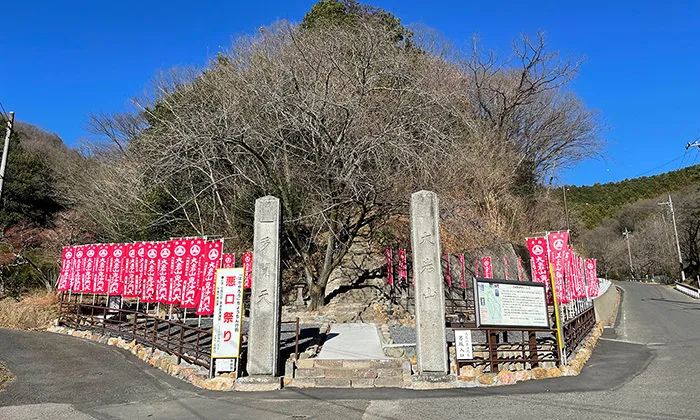
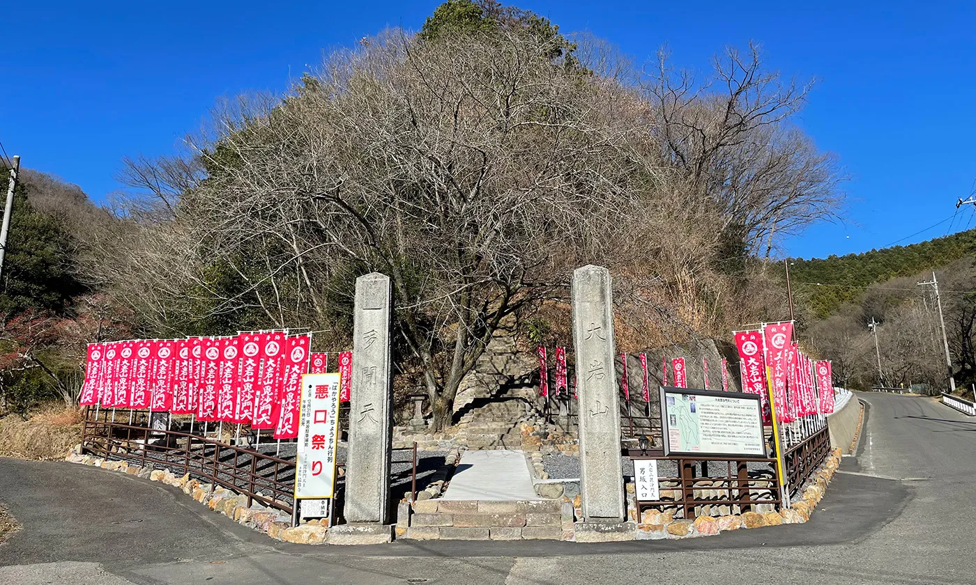
Recommended hiking course on Mt. Oiwa

From the foot of Mt. Oiwa, there are three trails: Otokozaka, Onnasaka, and a motorway. It is said that before the automobile road was built, worshippers climbed the Otokozaka and Onnasaka slopes since ancient times.
There is also a parking lot and restroom next to the stone-sanmon-gate at the entrance of the approach to the temple. Please make use of them.

Since ancient times, Mt. Oiwa has been a place of ascetic practice of Shugendo (mountain asceticism), and the entire mountain has been worshipped as a sacred place. Therefore, there are numerous trails within Mt. Oiwa, and you can hike on a variety of trails.


Hiking course for worship from Otokozaka to the top of the mountain

The entrance of Otokozaka of Mt. Oiwa

The entrance to Otokozaka is a stone-sanmon-gate next to the Otokozaka entrance parking lot.
The trail climbs straight up to Gyoki-daira. The slope is steep and the path is steeper than that of Onnazaka.
The exit of Otokozaka is Gyoki-daira. From Gyoki-daira, it takes only a few minutes to reach the entrance to the Bishamonten grounds.

VR tour of Otokozaka


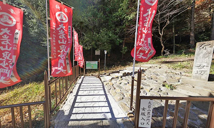
Hiking course for worship from Onnazaka to the top of the mountain

The entrance of Onnazaka of Mt. Oiwa

The entrance to Onnazaka is located about 10 minutes further up the motorway than the entrance to Otokozaka.
Onnazaka is a path that climbs up the valley line, with a relatively gentle slope.
On the way, a statue of Fudo Myoo is enshrined alongside the water source.
The exit of Onnazaka, like Otokozaka, leads to Gyoki-daira. From Gyoki-daira, it takes only a few minutes to reach the entrance to the Bishamonten grounds.

VR tour of Onnazaka


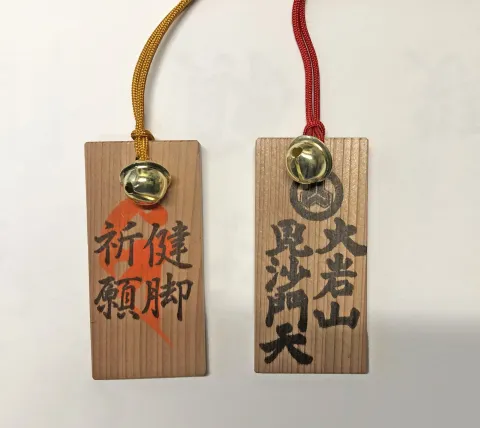
Amulet to pray for healthy legs

Prayer charm for healthy legs made of sacred tree in the precincts of Oiwasan Bishamonten

Oiwayama Bishamonten suffered damage from Typhoon No. 19 in 2019, which toppled a large cedar on the temple grounds.

The cedar was a sacred tree that was about 150 to 200 years old, counting the annual rings.

This time, we have made a wooden tag for praying for healthy legs using the cedar wood.

There is a handwritten Sanskrit character written by the 94th chief priest of Saishoji Temple (the name of the principal image of Bishamonten).

Please note that Sanskrit characters are sensitive to water, so if you plan to use them during rainy weather, we recommend that you protect them with a waterproof spray. Also, the grain of the wood varies depending on the wooden tag.

Quantities are limited, so please arrive early.


Transportation information to Ashikaga City

By train: Take the Tobu Isesaki Line from Asakusa Station to Ashikaga City Station. Approximately 70 minutes by limited express Ryōmo. Take the JR Tohoku Shinkansen from Tokyo Station to Oyama Station, then take the JR Ryomo Line to Ashikaga Station, approximately 80 minutes. Take the JR Ryomo Line from Takasaki Stationto Ashikaga Station. It takes about 60 minutes.

By car, it takes about 10 minutes from Ashikaga IC on the Kita-Kanto Expressway, and about 17 minutes from Ota Kiryu IC on the Kita-Kanto Expressway.


Transportation to Ashikaga City

The train usage and time from the Tokyo metropolitan area to Ashikaga City, and the time from the Kita-Kanto Expressway interchange to Ashikaga City by car are as follows. If you are coming to Ashikaga City on the Kita-Kanto Expressway, you can take the Kanetsu Expressway, Tohoku Expressway, and Joban Expressway.

  • About 70 minutes on the Tobu Isesaki Line from Asakusa Station to Ashikaga City Station on the Ryomo limited express train.
  • Take the JR Tohoku Shinkansen from Tokyo Station to Oyama Station and take the JR Ryomo Line to Ashikaga Station, approximately 80 minutes.
  • Approximately 60 minutes from Takasaki Station to Ashikaga Station on the JR Ryomo Line
  • To get to Ashikaga city by car, it takes about 10 minutes from Ashikaga IC on the Kita-Kanto Expressway, and about 17 minutes from Ota Kiryu IC on the Kita-Kanto Expressway.

Transportation and parking information to Mt. Oiwa

Below is information on how to get there by bus, taxi, or on foot from the nearest station, and the time it takes to get to Mt. Oiwa by car from the Kita-Kanto Expressway.

  • Oiwasan West Park is about 8 kilometers from JR Ashikaga Station (about 25 minutes by taxi)
  • Approximately 6 kilometers from JR Yamamae Station (approximately 15 minutes by taxi, approximately 60 minutes on foot)
  • Approximately 8 kilometers from Tobu Ashikagashi Station (approximately 20 minutes by taxi)
  • City Life Route Bus (Matsuda Line) Get off at Mie Post Office and walk for about 40 minutes
  • Approximately 30 minutes by car from Ashikaga IC on the Kita-Kanto Expressway, approximately 40 minutes from Ota Kiryu IC

*If you are coming by car, the road is narrow from the Otokozakaguchi parking lot to Oiwasan West Park. Also, please be aware that there are gutters on the mountain side of the road.


Worship course VR tour from the foot of Mt. Oiwa to the summit

Worship course VR tour from the foot of Mt. Oiwa to the summit
  • By clicking on the image above, you can see a worship course starting from the mountain path and sky above Mt. Oiwa.
  • Clicking on the link displayed above the spherical panoramic photo will take you to spherical panoramic photos of the sky and the ground of the mountain path of Mt. Oiwa, the precinct of Saishoji-temple and Oiwasan Bishamonten , and tourist spots scattered around Ashikaga City.
  • By operating the buttons located at the top of the screen, you can rotate left/right/up/down, enlarge/reduce the screen, switch VR mode, display full screen, etc.
  • VR mode provides a three-dimensional experience when viewed with VR goggles.
  • The map display at the top left of the screen can be enlarged or reduced, and the map can be switched, allowing you to check the registered spherical panoramic photo location, viewing direction, and visible range.